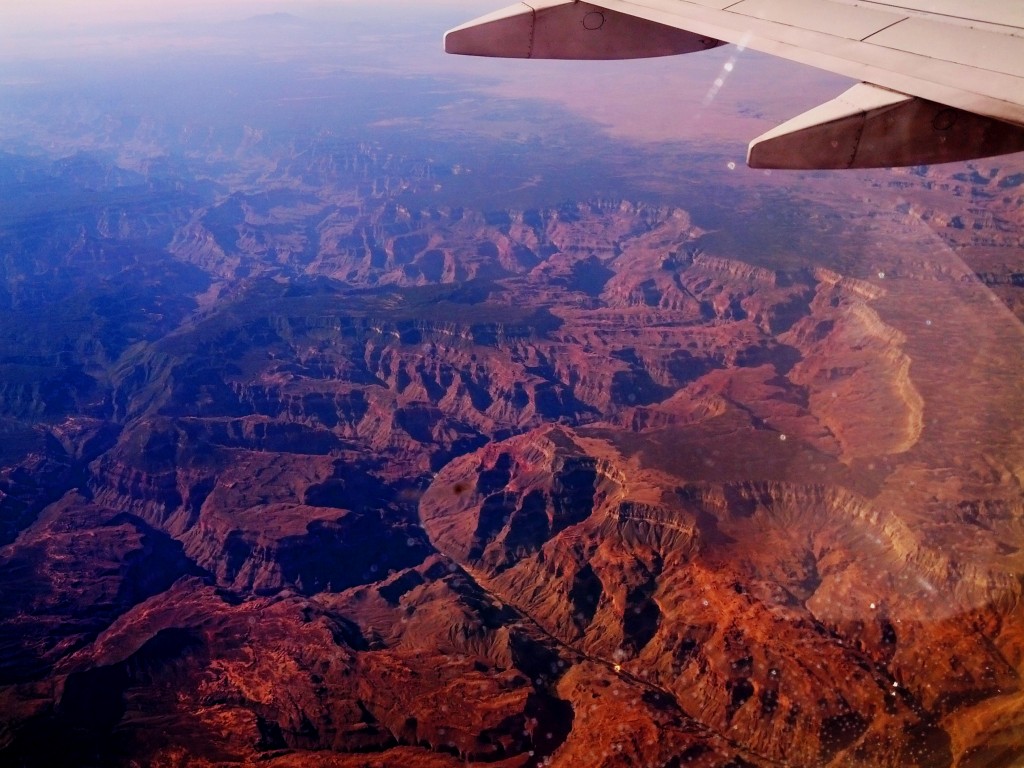
Flying Over the Grand Canyon


The Yankee Freedom II heading out to Garden Key where Fort Jefferson is built.
Inside of Dry Tortugas National Park Fort Jefferson is visible. Loggerhead Key can be seen in the background on the right with a tall lighthouse built on it. Loggerhead Key is not connected to Garden Key. For a map of Dry Tortugas National Park go here….
Loggerhead Key closer up. The only think on this island is the lighthouse.
As Fort Jefferson gets closer you can see the different in brick colors resulting from the different locations materials came from while this was being built. This beach is where we snorkeled from.
The Fort Jefferson Lighthouse. This is built inside the fort walls.
The Courtyard of the fort. Officers quarters are visible at the far end.
Fort Jefferson had many cannons. Here is an example of how they were set up. This fort was never fully armed due to the weight of the cannons which would cause Garden Key to sink even further.
Some of the many frigate birds that reside near Garden Key.
Bush Key is the closer island with Long Key further out. Long Key is where the frigate birds reside and is closed to public exploration in order to preserve the bird habitats.
As the Yankee Freedom II returned to Key West you can see the people beginning to gather to celebrate the sunset at Mallory Square.
On our last voyage to Southern Florida the main goal was to visit Everglades National Park. When planning a park trip we look at nearby national parks as well and in the process explored Biscayne National Park which we would never have gone to due to lack of knowledge about it. Another park that came up was Dry Tortugas National Park. This requires a boat ride or seaplane ride to get there as it is 70 miles off the coast of Key West . Due to the difficulty and expense in getting there we took it off the list. Having another opportunity this past winter we decided to plan a trip to Dry Tortugas if the weather was going to cooperate. This means warm, sunny, and low winds.
I was in Ft. Lauderdale for a convention and decided to extend the trip for a couple more days. Near the end of the convention I started watching the weather forecasts a little closer and saw expected highs in the upper 70’s with minimal wind. It couldn’t possible get any better so off to Key West to catch the Yankee Freedom II for a 2 1/2 hour boat ride to Fort Jefferson. The morning starts early with boarding at 7:30 am in order to get to the island and back before sunset. We had a beautiful trip with plenty of sun although it was a touch cool requiring sweatshirts. During our voyage out to Dry Tortugas National Park we saw a ship with a long trail of white debris behind it. Turns out this was a crew working to recover items off a Spanish shipwreck. They were out on a weekend because of the calm water from lack of wind. It was certainly interesting to see an actual shipwreck recovery in process.
Finally we arrived in the Dry Tortugas! These are a chain of very small islands but extremely beautiful. Docking at Fort Jefferson we quickly got off the boat as there were only 4 hours to explore this place. First we wanted to snorkel for an hour or so in these tropical waters. For being tropical waters it sure took some time to get use to the cool water. There were some great things to see such as a conch slowly moving along the sandy bottom and some squid in the sea grass but very little coral. After swimming for some time we heading in a different direction and discovered the coral. While enjoying the fish swimming in amongst the coral I noticed we were being watched by a barracuda. I get a little nervous around these fish as they have a reputation for being a little aggressive and seeing the rows of teeth covering their mouth just adds to that reputation. Fortunately this fish just continued to move ahead of us. After this short time in the cool water we dried off and got something to eat before touring Fort Jefferson.
Fort Jefferson was constructed around the civil war and was one of the few southern locations aligned with the Union armies. This fort takes up almost the entire island and was built to house up to 2,000 soldiers however it was never completed. As the construction continued the island began to settle (sink) under the weight of all the bricks and other construction materials used. Prisoners were kept here and the most famous of those were 4 men convicted of helping in the assassination of Abraham Lincoln. There is some fascinating history being preserved at Dry Tortugas National Park. I understand why this was placed under the national park system.
After learning about this fort and it’s history and exploring under the surface of the ocean it was time for the journey back to Key West. I would have liked to stay longer and take more time to explore but we did not plan for it on this trip. Camping is possible and would give more time for snorkeling and exploring the fort along with experiencing the peacefulness and solitude of the Dry Tortugas. This is one of the least visited national parks for obvious reasons. If you are ever in the area, I highly recommend this opportunity!
The planning for this summers Monopoly National Parks board trips are in full progress. Our destinations include Yosemite National Park which includes a stop at Ahwahnee for dinner and Isle Royale National Park. These were expected to be fairly easy trips to plan because we’re meeting some friends in California and then heading to Yosemite for a few days. This is a somewhat familiar area for us as we have been there visiting various friends and relatives so we have a good idea of what we need to do and where to go. Isle Royale is the closest park to us on the Monopoly Board so again should be fairly easy to plan for.
As is often the case, what should be the easiest may turn out to be one of the biggest challenges. The challenges with Yosemite come in from finding a suitable place to stay. We questioned camping however that idea came a few days to late as it was a few days after campsite reservations became available. Apparently campsites fill up minutes after becoming available. Who knew? Certainly not me. A good learning experience. There’s a few options left but we probably should get it nailed down soon or there may be no more options left.

Isle Royale is one of the locations I was most excited to see since it is practically in my own back yard and yet provides a very different atmosphere than I am use to. Since this is within a few hours drive time (~5 hours to be exact) we could take a quick trip to Northern Minnesota, hop on a boat for a couple of hours, tour the area close to one of the visitor centers, and get back on the boat for a return trip to our car and be done. Did I mention that this park requires special transportation since it is on an Island in Lake Superior? Interestingly this is the one place where Minnesota and Michigan border each other.
I have wanted to camp in the Boundary Waters Canoe Area for a number of years and have not fulfilled that desire. Camping on Isle Royale would qualify in my opinion. Unfortunately we are restricted to 40 pounds of gear each on the boat without further costs. The boat ride already is getting more expensive than I was counting on at $67 per person per way bringing a total for 4 of us to $536 just to get there. That does not include a fuel surcharge, parking, and park fees. In order to camp on the island we are going to need full camping and hiking gear including a tent, backpacks, food, water, cooking supplies, etc.… 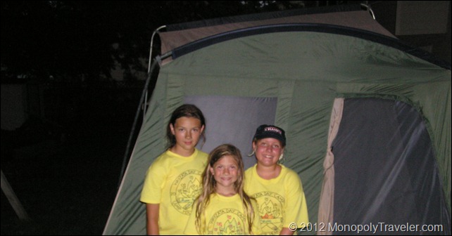
I don’t’ think my 10 person tent is going to work very well on this trip. It could very well weigh 40 pounds all by itself. When the realization of what we are up against hit me it was very daunting and exciting. Never camping while hiking before makes me a little nervous. Now add that I’m going to be going with my wife and two younger children really added to this nervousness. I’ve been spending countless hours researching Isle Royale and what is needed in order to make this a great experience for all. My nerves have been settling after reading and looking at necessary equipment. The excitement is returning for mid-August when this trip is planned for. Fortunately I started planning for this early enough to locate what we need and practice a little before we go. Now the big question is – can I carry 40 pounds of gear while hiking for several days? Also, can we fit everything we need into the packs for me, Karen, and the kids? Okay, so there are more than just one question at this time. In addition, we are hoping to include Voyageurs National Park for a few days. This also presents challenges since much of this park requires a boat. Still much to learn and prepare for.
Cadillac Mountain in Acadia National Park is the first place in the United States to see the sun rise during the winter months. This is because this location is far enough east in Maine and high enough to see the sun rise before areas that are further east. People like to be the first to do many things or experience something for the first time. Here is a place that anyone can do something before anyone else in the United States – watch the sun pierce the horizon. Unfortunately we did not make it to Cadillac Mountain to witness the sun rising but we still enjoyed setting foot in the beautiful Mountain. Even if we had it was during the summer so the first place to see the sun rise would have been Mars Hill, Maine.
My first impression of Cadillac Mountain was looking at it on a map while looking for the highlights of Acadia National Park. It was puzzling how this could be considered a mountain at only 1530 feet above sea level. I’m use to mountains being several thousand feet above sea level. After getting there and learning more about this place, I now understand why it’s considered a mountain. First of all the steep ascent from sea level to the top suggests a mountain. Also, according to geologists, what is currently the top of Cadillac Mountain was the center of the volcano which helped to shape this area. Apparently the mountain use to be considerably taller until the glaciers moved through and cut it down giving us the scenery available today.
After watching the sunset in other areas of the park we headed back to the top of Cadillac Mountain to witness a beautiful star filled sky. Most impressive was seeing the Milky Way. I have not seen it in a number of years so it was nice to be reminded of its’ spectacular display. Also, fewer and fewer people are able to see the Milky Way so it was nice to show our children what it looks like. Unfortunately I need to work on my photography skills capturing stars so I don’t have a picture that shows the milky way in all its glory. I was able to get a nice photo of the big dipper.
Exploring the Freedom Trail in Boston, Massachusetts provided several experiences that led to a greater appreciation for our Independence and freedom. Witnessing the sights of the Boston Massacre and Bunker Hill where the first battle of the Revolution took place to the Old North Church made famous for the ‘one if by land and two if by sea’ begins to make you realize some of the things involved in bringing about our Independence. History classes teach of Paul Revere warning about the British by signaling which direction they were coming from and his famous ride through Boston shouting “the British are coming, the British are coming!” Apparently he was involved in many planning sessions leading up to the Revolutionary War and was integral during the war as well. But what else did Paul Revere do?
I was surprised to learn that he was a metal smith working with copper, gold, and silver. Many of his works were put into a number of building which can be seen on the Freedom Trail such as the Massachusetts State House and the USS Constitution. We visited Paul Revere’s gravesite along with other recognizable names from that time including John Hancock and Samuel Adams. Seeing all of these places brought a further appreciation for the freedoms I enjoy every day and also a few questions. There are people often saying the government is getting to much control. What conditions did the people of the 1770’s have to contend with that war was justified? What conditions would cause the American people today to revolt against the government? I believe we would have to lose a lot more freedoms to justify severe actions like the colonists took. When I compare what those colonists lived with to what we deal with today, we are very fortunate. Staying involved in our government is still very important to prevent those conditions from every becoming reality.
Another interesting occurrence surprised me while visiting these places. I continued to have difficulty in believing that I was seeing these historic landmarks. I kept saying that even though I was physically at a location, it didn’t make the events that occurred there any more real. Trying to believe that what happened over 300 years ago was in that exact place was difficult. I know buildings have been re-furbished and updated making them less
realistic to me. Also, the surrounding buildings make it hard to imagine what people such as Paul Revere lived like and the difficulties in coordinating revolutionary activities. Even visiting the grave site didn’t help to bring me to the 1770’s. Some of the issues were many of the building being brick. Looking at renderings of these building when they were originally built show them mainly built out of wood. Also, Paul Revere’s house is still standing and that was made out of wood. Historical buildings being remodeled along with the skyscrapers that exist next to them now give a very different perspective. Even so, what a great learning experience!
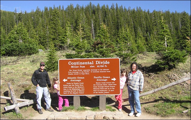
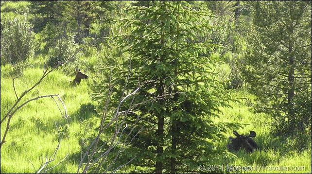
Once reaching the visitor center for a second time it was off in search of moose. We were informed that moose were spotted more frequently on the other side of Rocky Mountain National Park so we continued on Trail Ridge Road towards the Continental Divide and Milner Pass. As we reached Milner Pass there were no signs of Moose. Stopping to take the requisite photo of the Continental Divided (where the water from one side of this divide heads towards the Atlantic Ocean and water from the other side goes to the Pacific Ocean) the question of how much further do we want to explore as the day was growing long and the trip back to our lodge would take some time. We decided to press on and fortunately we did because soon we came upon another area with a lot of cars which usually means there is something in the area to see.
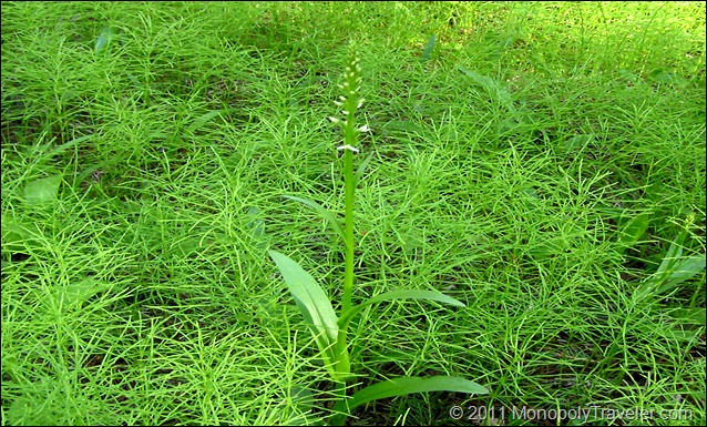
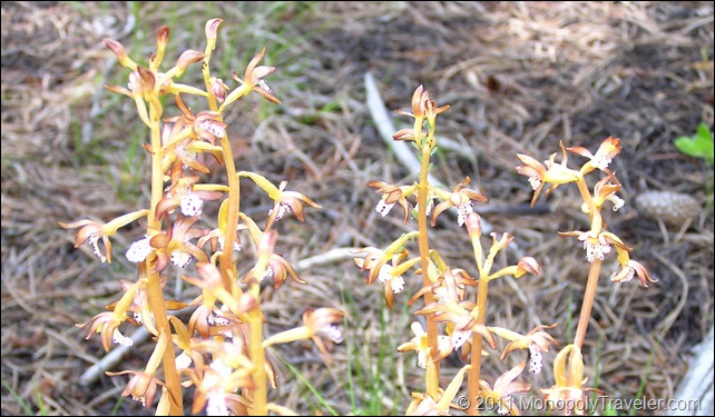
For the second day in Rocky Mountain National Park there were two ranger programs of interest and a few animals that had eluded us of which we wanted to find if possible – moose and big horn sheep. The first ranger program was at Lily Lake and highlighted wildflowers that were in bloom around the park. It was great to find out what some of these beautiful flowers where that we had been seeing while exploring different areas. Towards the end of the program our ranger mentioned where a few orchids could be found in bloom sending us off on a minor expedition to see if we could find one. After a short time walking there they were! These orchids were only visible to those that were looking and had an idea of where they were otherwise they are well adapted to the environment and somewhat difficult to spot. This stop at Lily Lake provided a great view of Longs Peak, the tallest peak in RMNP. Our next program of interest was again a 30 mile drive to another area in the park so off we went with enough time to stop for lunch.
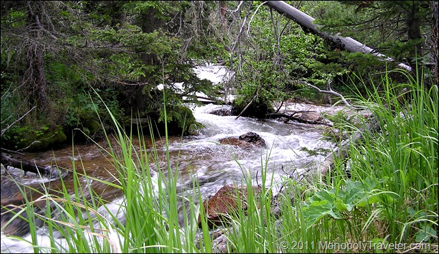
This program highlighted elk and the habit necessary for them to survive. More great information about elk and their seasonal migrations along with what is being done at RMNP to keep the herd sizes at manageable sizes. Some of the controls included adding fencing to certain areas to allow plants re-grow and establish while keeping elk out reducing some of the food available. A short hike going through areas that elk like to feed and drink where a part of this program. This hike meandered into the fenced off area allowing us to see plants re-growing and how much grazing by the elk has diminished available food. After the program we inquired about the best places to see moose and big horn sheep allowing us to focus on certain places to provide the best chances at achieving this goal. With that information in hand we were off. Along the way there were a few waterfalls that we wanted to see which were somewhat larger than those we had already viewed.
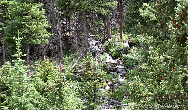
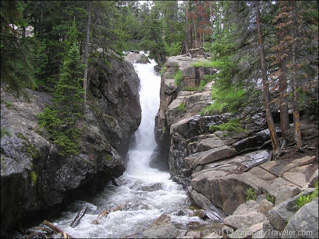
One of these waterfalls was located on Old Fall River Road which is a one way gravel road that winds narrowly up the mountainside. There were times I was uncertain if this was a good idea as the road winds back and forth with the edge not far away. Drive carefully or you could be going over the side and taking a ride you were not prepared for. Just before this road there is a picnic area with a small trail that heads towards a very tall waterfall hidden deep in the trees. It is difficult to see the entire fall but still very beautiful for the parts that you can see. Continuing on to Old Fall River Road towards Chasm Falls, you begin to feel like you are in a secluded area as the road is gravel and narrow with trees sheltering much of the passageway. The only reminders of civilization are the number of other adventures traveling this road and paved trails at certain overlooks. This waterfall reminds of the power that water has as it moves and carves large boulders to shape the river. It can almost be imagined the millions of years it takes to really change this landscape just by the size and placement of certain boulders as you explore along this waterfall. As you continue this drive you wind up one side of the mountain and then cutback heading towards the other side of the mountain meandering slowly higher while catching a quick view of a snowfield higher up or a larger stream created from melting snow. Eventually this drive brings you above the tree line allowing you to see how far you have climbed on this winding old road and how close you have moved towards the top. Shortly after reaching the tree line, Alpine Visitor Center is back in view. This drive takes awhile but is well worth it if you can overcome the fear of driving so close to the edge of the road where the drop off could be 100’s of feet below and take in all that is around you.
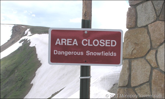
While exploring the displays in Alpine Visitro Center, some other explorers entered telling park rangers that a Wolverine was spotted not that far away. I rushed outside in hopes of catching a glimpse of this rarely seen animal in RMNP without success. Not really knowing what a wolverine looks like I perused the displays until I spotted a photo of one. Listening to park rangers tell about wolverines was interesting and hearing their thoughts on why this one was wandering around proved fascinating. Their theory was this wolverine was looking for a mate and that if one was not found soon it would head further north out of Rocky Mountain National Park. While keeping an eye out in the area where the wolverine had recently been spotted we scanned the scenery where deep snow fields blended with areas of brown indicating where the snow had just retreated from a day or two earlier. Areas where the snow had melted several days before where already green as plants had begun there quick summer season with other plants not far away blooming. It was interesting to see this summer progression of the snow receding and giving way as life returned to the hillsides.
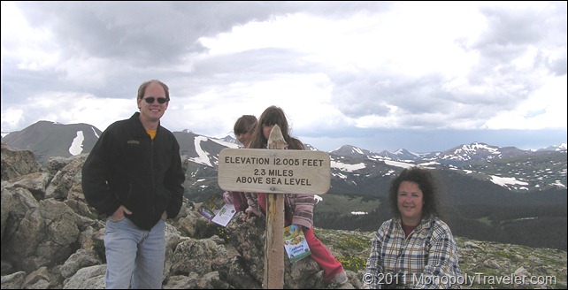
We decided to grab something to eat at the cafeteria located near the Alpine Visitor Center before proceeding on with our adventure. After a few moments of rest and eating we headed off to climb the Alpine Ridge Trail which would end up being the highest elevation we would reach during our time in RMNP. This was a short trail with a lot of climbing requiring us to move slowly as the elevation provides less oxygen making breathing more difficult. Park recommendations are to reach your summit by early afternoon as lighting becomes more likely later in the day so we were in a little bit of a hurry in order to avoid being at the top of this trail during the mid and late afternoon. Another great view of the mountains which surrounded us! From here you can see where the Colorado River begins its journey towards the Grand Canyon along with so many other mountain peaks. Heading back down towards our vehicle we spotted several dark clouds heading our way but we managed to get to the top and back down without experiencing lightning first hand at the top of a mountain.
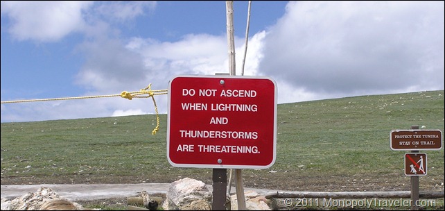
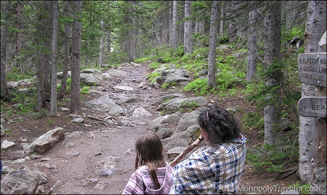
On to find the trail that takes a spot on our National Parks Edition Monopoly Board – Flattop Mountain Trail. This required driving over 30 miles to Bear Lake to reach the trailhead leading to our targeted destination. During this drive there was once again incredible scenery from all of the flowers blooming along the roadside to rapidly flowing rivers. I found several types of flowers I would like to add to my yard someday. It is a little more difficult to create all of the snow melting into rivers in my yard so I just need to enjoy the photos and memories for now. Once Bear Lake was reached we headed for the trails and began ascending towards our objective. This was a short 2 mile hike with the intention of staying below the tree line so as to avoid any possible threat of lightning. As we reached Flattop Trail we took a few moments to rest and take in the surrounding of stones, trees, and the occasional critter wandering in the forest. It was starting to get late in the day and we were tired after all of our hiking and exploring so the decision was made to descend back to the car and return to the lodge for food and a good nights sleep.
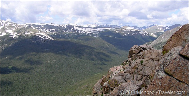
There are a couple of National Parks on our Monopoly board that stand out to me as the places I am most eager to see. One of them was Rocky Mountain National Park (RMNP). I have enjoyed all of the national parks we have visited to this date but RMNP is so far my favorite national park. There are some great places yet to come so I expect this may not remain my top pick in the end but for now this is the park I think of first when talking about national parks. What makes this my favorite national park? The elk, moose, marmots, the tundra in bloom, picturesque snowcapped mountains, wild orchids, waterfalls, beautiful lakes and rivers, intriguing trails, and on and on and on… Does it appear as though I enjoyed our time here?
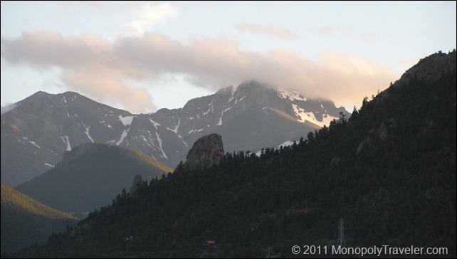
We entered Colorado from the plains of the Mid-west. The mountains continued to grow larger in the background until we were at the base of the Rocky Mountains beginning our ascension towards the top. Our climb towards the top started slowly at first and then quickly became steeper and steeper as we drove higher towards RMNP. Watching the trees and rocks all around us was mesmerizing complimented by the raging rapids from the snow melting higher in the mountains. After a short time we entered Estes Park where one of the entrances to Rocky Mountain National Park resides. We settled in at our lodging for the next couple of days and prepared to go exploring in the mountains for the next couple of days.
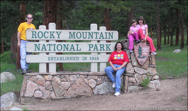
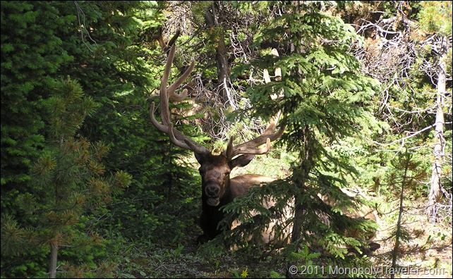
The next morning we grabbed some breakfast and headed out to continue our adventure. Upon entrance to RMNP we browsed over the activities available for the day and began our drive towards the Alpine Visitor Center. As we meandered along we came upon a traffic jam. Further inquiries declared there were a few elk rested in the area. Driving along a little further we spotted an elk. This one happened to be a bull with horns towering above his head completely covered in velvet indicating they were still developing. For us this was exciting as we have never seen a bull elk before. While visiting Wind Cave National Park we watched a heard of elk in the distance but there were no bulls visible in that heard. Spending a few moments we snapped a few pictures of the elk and enjoyed the surrounding landscape and then off towards the visitor center once again.
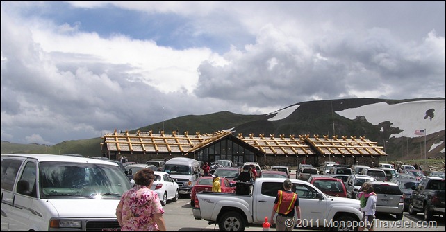
Our road trip to Alpine Visitor Center would have been much faster had there not been so many places to pull over and gaze in amazement and the snow covered peaks where the snow was melting. Streams of melted snow turned into rivers with beautiful waterfalls and violent rapids allowing us to get lost in these scenic moments and lose track of time. There were at least 4 stops off of Trail Ridge Road on the way to the visitor center each one capturing our interest and providing a unique look at these mountains. Along the way we encounter snow drifts that had covered this road weeks before. Some of them were at least 10 feet tall reminding us of the harsher times of year and the amazing feat required of animals and plants in order to survive this environment. At our last stop before reaching our destination a marmot appeared in and out of rocks while crawling around on the tundra which was full of plants displaying their beautiful flowers showing the attraction of this alpine terrain. Eventually we arrived at the visitor center where Lysa and Kristy began their journey towards another Junior Ranger Badge.
To Continue to Part II Click Here…